

O.E.S. Flood Contingency Mapping
Reclamation Districts (PDF) (4.9M)
Unified Flood Fight Commands (PDF) (5.0M)
Incident Management Divisions (PDF) (2.7M)
Unified Flood Fight Commands (PDF) (5.0M)
Incident Management Divisions (PDF) (2.7M)
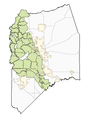
VISUAL INDEX OF AVAILABLE MAPS
TABULAR INDEX OF AVAILABLE MAPS AND PLANS
Note: Some of these files are quite large.
| RD# | NAME | MAP | EOP | PED |
|---|---|---|---|---|
| 1 | UNION ISLAND |  |
|
n/a |
| 2 | UNION ISLAND WEST | |
|
n/a |
| 17 | MOSSDALE TRACT | |
|
|
| 38 | STATEN ISLAND | |
|
n/a |
| 348 | NEW HOPE | |
|
n/a |
| 403 | ROUGH AND READY ISLAND | |
|
n/a |
| 404 | BOGGS TRACT | |
|
|
| 524 | MIDDLE ROBERTS ISLAND | |
|
n/a |
| 544 | UPPER ROBERTS ISLAND | |
|
n/a |
| 548 | TERMINOUS | |
|
n/a |
| 684 | LOWER ROBERTS ISLAND | |
|
n/a |
| 756 | BOULDIN ISLAND | |
|
n/a |
| 773 | FABIAN TRACT | |
|
n/a |
| 828 | WEBER TRACT | |
|
|
| 1007 | PICO & NAGLE | |
|
n/a |
| 1608 | SMITH TRACT (LINCOLN VILLAGE WEST) | |
|
n/a |
| 1614 | SMITH TRACT | |
|
|
| 2023 | VENICE ISLAND | |
|
n/a |
| 2027 | MANDEVILLE ISLAND | n/a | n/a | n/a |
| 2028 | BACON ISLAND | |
|
n/a |
| 2029 | EMPIRE TRACT | |
|
n/a |
| 2030 | MCDONALD ISLAND | |
|
n/a |
| 2033 | BRACK TRACT | |
|
n/a |
| 2037 | RINDGE TRACT | |
|
n/a |
| 2039 | JONES TRACT, formerly: 2038 LOWER JONES TRACT & 2039 UPPER JONES TRACT |
|
|
n/a n/a |
| 2040 | VICTORIA ISLAND | |
|
n/a |
| 2041 | MEDFORD ISLAND | |
|
n/a |
| 2042 | BISHOP TRACT | |
|
n/a |
| 2044 | KING ISLAND | |
|
n/a |
| 2058 | PESCADERO DISTRICT | |
|
n/a |
| 2062 | STEWART TRACT | |
|
n/a |
| 2064 | RIVER JUNCTION | |
|
n/a |
| 2072 | WOODWARD ISLAND | |
|
n/a |
| 2074 | SARGENT-BARNHART TRACT | |
|
n/a |
| 2075 | MCMULLIN RANCH | |
|
n/a |
| 2085 | KASSON DISTRICT | |
|
n/a |
| 2086 | CANAL RANCH | |
n/a | n/a |
| 2089 | STARK TRACT | |
|
n/a |
| 2094 | WALTHALL | |
|
n/a |
| 2095 | PARADISE JUNCTION | |
|
n/a |
| 2096 | WETHERBEE LAKE | |
n/a | n/a |
| 2101 | BLEWETT | n/a | n/a | n/a |
| 2107 | MOSSDALE | |
|
n/a |
| 2108 | TINSLEY ISLAND | n/a | n/a | n/a |
| 2113 | FAY ISLAND | |
|
n/a |
| 2114 | RIO BLANCO TRACT | |
|
n/a |
| 2115 | SHIMA TRACT | |
|
n/a |
| 2116 | HOLT STATION | n/a | n/a | n/a |
| 2118 | LITTLE MANDEVILLE ISLAND | n/a | n/a | n/a |
| 2119 | WRIGHT-ELMWOOD TRACT | |
|
n/a |
| 2126 | ATLAS TRACT | |
|
n/a |
| 9001 | ZONE 9 CENTRAL STOCKTON | |
|
n/a |
| 9002 | ZONE 9 EAST STOCKTON | |
|
n/a |
| 9003 | ZONE 9 NORTH STOCKTON | |
|
|
| 9004 | ZONE 9 SOUTH STOCKTON | |
|
n/a |
HISTORY:
2019-07-05: Jones Tract consolidation (LAFC 28-18)
2016-07-29: initial publication
2016-07-26: misc: uffc map, 348 eop, 2094/2096 map, peds
2016-07-21: a few doc name revisions
2016-07-14: draft visual index added
2016-07-01: created, draft under construction